Latest
WELCOME TO
PARADEEP DEVELOPMENT AUTHORITY


Notice Board
Project & Scheme
Shopping Complex at Kujanga. 104 nos. of shop rooms have constructed and allotted to the general public through lottery.
Site & Services Scheme at Nimidhi The Paradip Development Authority has been executed a Site & Services scheme in mouza, Nimidhi. There are 94 nos. of developed plots have been allotted to the general public through open lottery. |
CONSTRUCTION OF OFFICE BUILDING OF PARADIP DEVELOPMENT AUTHORITY
The P.D.A. has proposed for construction of office Building of P.D. A at Paradip near Spl. Circuit House.
PROPOSED SCHEM OF P.D.A.
- CONSTRUCTION OF RESIDENTIAL APARTMENT ON PPP MODE AT PANKAPAL
- DEVELOPMENT/CONSTRUCTION OF COMMERCIAL/RESIDENTIAL APARTMENT IN MOUZA, PARADIPGARH
PARADEEP DEVELOPMENT AUTHORITY
Consequent upon the declaration of Paradip as a census town in 1971 and its subsequent growth, the Paradip-Jagatsingpur Regional Improvement Trust (PJRIT) was set up by the Government of Orissa extending provisions of the OTP & IT Act, 1956.
A Master Plan for a proposed civil township was prepared by the Directorate of Town Planning, Orissa covering 42 revenue villages surrounding the census town (now 43, after creation of Chunabelari from Paradipgarh). This Master Plan was finalised in 1987. Thereafter, 77 new villages were included in the Master Plan area in three different phases (Phase 1- 70 nos, Phase 2 – 2 nos and Phase 3 – 5nos).
Subsequently, based on the potential and growth trend of the area, the State Government upgraded the PJRIT to Paradip Development Authority (PDA) in their Notification No. 25950/ HUD, dated the 7th Nov 2005.
Location
Paradeep Development Authority
Paradeep Port
Paradeep, famous for its seaport in the east coast of India, is located in Jagatsinghpur District of the state of Orissa at a distance of 98 km from Cuttack and 120 km from State Capital Bhubaneswar. It lies in between 860 15' to 860 45' E longitudes and 200 15' to 200 30' N latitudes and is connected with Cuttack city through the State Highway 12 running through Kujang, Tirol, Raghunathpur and Kandarpur. The National Highway 53 connects Paradip via Chandikhol, Kendrapara and Bhutmundai. A branch line from the East Coast Railway main line, running between Howrah and Chennai, links Cuttack with Paradip over a distance of about 85 kilometers. This linkage, originally opened for transportation of goods has been used for passenger transport service through passenger trains plying daily between Paradip, Cuttack and Bhubaneswar. The Paradip Port is 210 nautical miles south of Kolkata Port, 260 nautical miles north of Vishakhapatnam Port and 598 nautical miles north of Chennai Port.
The Authority area is surrounded by river Mahanadi in the north, Ersama and Tirtol CD Blocks in the south and the south-west and by the Bay of Bengal in the east direction.
About Paradeep
INTRODUCTION :
Paradeep is one of the Major Ports of India and late Sri Biju Patnaik, the then Chief Minister of Orissa, is the founder father of Paradip Port. Pt. Jawaharlal Nehru, the then Prime Minister of India, laid the foundation stone of the Port on 3rd January 1962 near the Confluence of river Mahanadi and Bay of Bengal. Government of India took over the management of the Port from the Government of Orissa on 1st June 1965. INS “INVESTIGATOR” had the privilege of maiden berthing in the Port on the 12th March, 1966.
The Port was declared open by Mr. Peter Stambolic, Prime Minister of Yugoslavia on the same day. Government of India declared Paradip as the Eighth Major Port of India on 18th April 1966 making it the FIRST MAJOR PORT in the East Coast commissioned after independence.The Port of Paradip, an autonomous body under the Major Port Trusts Act, 1963 functioning under Ministry of Shipping is administered by a Board of Trustees set up by the Government of India headed by the Chairman, PPT. The trustees are nominated by Government of India from various users of the Port such as shippers, ship owners; Government Departments concerned and also port labour. The day – to – day administration is carried out under general supervision and control of the Chairman, assisted by the Deputy Chairman and other departmental heads.
LOCATION :
Paradip port is situated 210 nautical miles south of Kolkata and 260 nautical miles north of Visakhapatnam.
Latitude 20° – 15′-55.44″ N
Longitude 86° -40′-34.62″ E
METEOROLOGICAL DATA :
| Maximum Temperature | 41.4 C. |
Minimum Temperature | 8.9 C |
Average Annual Rainfall | 1480 mm |
Average Wave Height | 1.50 mtrs. to 2.50 mtrs. (summer) |
Average Wave Height | 0.90 mtrs. to 1.20 mtrs. (winter) |
Maximum Wave Height | 5.30 mtrs. |
Minimum Tide | 0.40 mtrs. |
Maximum Tide | 3.50 mtrs |
Wave direction (April-September) | S.W. |
Wave direction (October-March) | N.E./E. |
Average Wind Speed (Summer) | 35 to 42 Km/Hr |
Average Wind Speed (Winter) | 18 to 24 Km/Hr |
PORT ESTATE :
The Port estate extends over a sprawling area comprising about 6,382 acres. Some portion of the Port land has been leased out for cargo related activities, construction of office/residential buildings of users directly connected with the activities of the Port. The Port Trust also allot residential quarters, shopping units and premises for offices of Port users, Central and State Government authorities on deposit of prescribed license fees. Port has also constructed 8 nos. of Cyclone shelters at different locations of Paradip Port for the People of Paradip.
PORT TOWNSHIP :
The Port Township has a population of more than One lakh. The Port Trust staff colonies are located in Madhuban, ‘V’ Point and Atharabanki areas. The Port has also provided required accommodation for office/residence purposes to various users of the Port in the staff colonies.
HOSPITAL :
The Port Trust has a modern 64 bedded hospital with adequate number of qualified doctors and specialists for treatment of Port Trust employees and their dependants. Port users, shipping agents and others based at Paradip Port are also permitted to use the hospital facilities. The port also runs a First -aid Centre inside the Cargo Berth area. The Hospital is an ISO certified, and equipped with an authorized bio-medical disposal system. In addition, there is a 20 bedded hospital at Atharbanki run and administered by the Govt. of Odisha.
SCHOOLS & COLLEGES :
There are two Schools i.e. one High School and one ME School operated by Paradip Port. One Central School fully subsidized by the Port Trust and an English Medium School run by Bethany Convent also operate at Paradip. Apart from these, Saraswati Vidhya Mandir , Municipal High School , DAV public school, Municipal Girls High school, Sanjay Gandhi High School and a number of other schools are imparting education at Paradip Port. There is one Port aided School located at “V” Point as K.G. School. A number of Schools for Dance & Music are also functioning in the Port town. Paradip College offering degree course in Arts, Science as well as Commerce with honours subjects is available at Paradip Port.
CONNECTIVITY :
The Port is connected with Broad-gauge electrified Railway system of the East-Coast Railway and is also served by National Highway No.5A and State Highway No.12. Port is well connected with Cuttack and Bhubaneswar with bus & train services. The Port is also connected by bus routes to the steel city of Rourkela and to the holy town of Puri & Konark. The Port is connected through lease line and broadband to other Ports, Ministry and IPA. Reliance, BSNL, Airtel, TATA Indicom etc. have cellular services at Paradip Port.
MARKET, HOTELS & RESTAURANTS, ENTERTAINMENT :
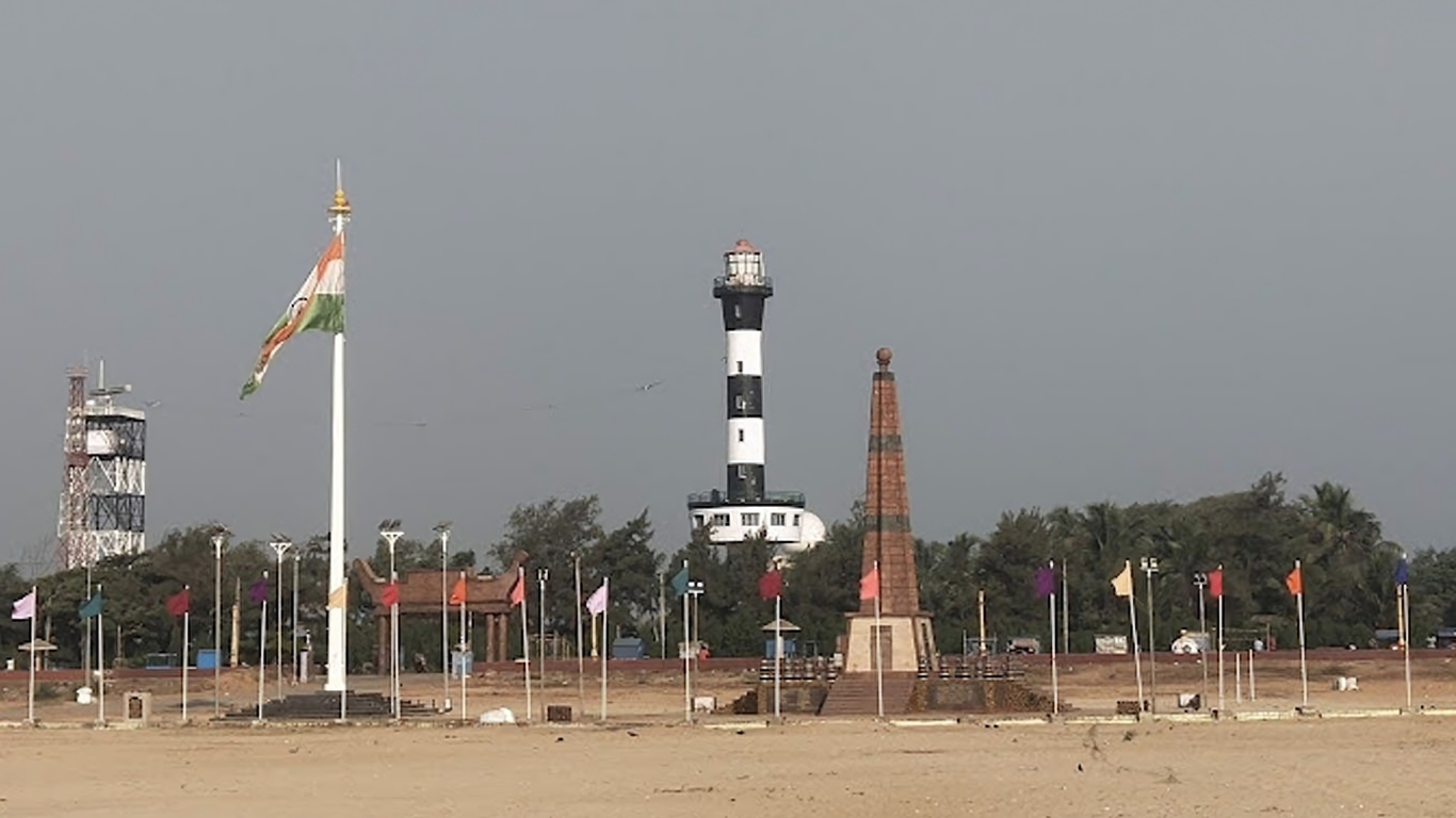
The Port has a good market complex along with many hotels and restaurants. Besides, the Port Trust has one eighteen- suit guesthouse overlooking the sea at Sector-21. Situated at the confluence of river Mahanadi, Paradip is a vibrant township and an island of excellence. It offers not only an efficient Deep Sea Port but also a few sights of tourist interest such as “Muhan” at Sector- 21, the ‘Cavana’ and the white sands of the Light House beach, the musical fountain at the sylvan gardens of “Smruti Udyan”, the Officer’s club and Gopabandhu Stadium with swimming pool plus a host of other facilities, the ‘fourteen-Holes’ Golf course and last but not the least, is the famous Paradip hospitality. A maritime museum and an aquarium equipped with 28 tanks consisting of a variety of marine and fresh water species of fish are the latest attractions for the visitors to the Port.